

Gulf of Thailand, อ่าวไทย, RTGS: Ao Thai, also known in to Malays as Teluk Siam literally meant Gulf of Siam, is a shallow arm of the South China Sea.
The Gulf of Thailand is bordered by Cambodia, Thailand and Vietnam. The northern tip of the gulf is the Bay of Bangkok at the mouth of the Chao Phraya River. The gulf covers roughly 320,000 km². The boundary of the gulf is defined by the line from Cape Bai Bung in southern Vietnam (just south of the mouth of the Mekong river) to the city Kota Baru on the Malaysian coast. At the height of the last ice age the Gulf of Thailand did not exist, due to the lower sea level, the location being part of the Chao Phraya river valley.
The Gulf of Thailand is relatively shallow: its mean depth is 45 m, and the maximum depth only 80 m. This makes water exchange slow, and the strong water inflow from the rivers make the Gulf low in salinity (3.05-3.25%) and rich in sediments. Only at the greater depths does water with a higher salinity (3.4%) flow into the gulf from the South China sea and fills the central depression below a depth of 50 m. The main rivers which empty into the gulf are the Chao Phraya (including its distributary Tha Chin River), Mae Klong and Bang Pakong Rivers at the Bay of Bangkok, and to a lesser degree the Tapi River into Bandon Bay in the southwest of the gulf.
Extent
The International Hydrographic Organization defines the southern limit of the Gulf of Thailand as "A line running from the Western extreme of Cambodia or Camau Point (8°36'N) [Note: this point is actually in Vietnam] to the Northern extreme of the point on the East side of the estuary of the Kelantan River (6°14′N 102°15′E)".
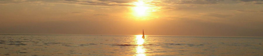
Tourism
The Gulf of Thailand harbours many coral reefs, and thus several diving resorts. Due to the tropical warmth of the water, it is popular with tourists. Some of the most important tourist destinations in the Gulf of Thailand are the islands of Ko Samui and Ko Pha Ngan in Surat Thani province, Pattaya in Chonburi province, Cha-am, Hua Hin, Ko Samet and Ko Chang.
Ko Tao is a center of the diving tourism.
Territorial disputes
There are territorial disputes in the area between Malaysia, Thailand, Cambodia and Vietnam.
Malaysia and Thailand in particular have chosen to jointly develop the disputed areas, which include the islands of Ko Kra and Ko Losin. A long-standing dispute between Cambodia and Vietnam in the Gulf of Siam concerns mainly the island of Phú Quốc, which is located off the Cambodian coast. Cambodia also claims 48,000 km2 of shelf area.
